
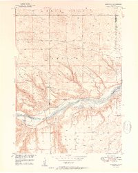
1950 Map of Mariaville
USGS Topo · Published 1950About this map
The Niobrara River flows through the center of this Nebraska landscape, where the sandy, dissected plains meet the river's wide alluvial channel. This 1950 edition, part of the Missouri River Basin development program, shows the rural settlement of Mariaville situated just south of the river. The area's agricultural life is marked by a network of one-room schoolhouses, including School No 86 on the northern bluffs and School No 14 to the south. Numerous family-named drainages like Haughan Creek and Simpson Creek feed the Niobrara, while landmarks such as Simpson Cem provide points of interest for genealogists and local historians. The presence of multiple cattle-ranching features, including several noted Windmills, reflects the ranching economy that dominated these prairie lands at mid-century.
Find a feature on this map
25 named features on this map. Tap any name to fly to it.
Don’t see what you’re looking for? This feature index may not catch every label — zoom into the map to look around manually.
Map Details
Editions of this 1950 Mariaville Map
2 editions found
Other maps of this area

1949 · Jamison SW
USGS Topo · 1:24,000

1949 · Carns
USGS Topo · 1:24,000

1950 · Carns
USGS Topo · 1:24,000

1951 · Jamison SW
USGS Topo · 1:24,000

1951 · Naper SW
USGS Topo · 1:24,000

1954 · Stuart NW
USGS Topo · 1:24,000

1954 · Newport NE
USGS Topo · 1:24,000

1955 · O'Neill
USGS Topo · 1:250,000

1959 · O'Neill
USGS Topo · 1:250,000

1964 · Mills
USGS Topo · 1:24,000