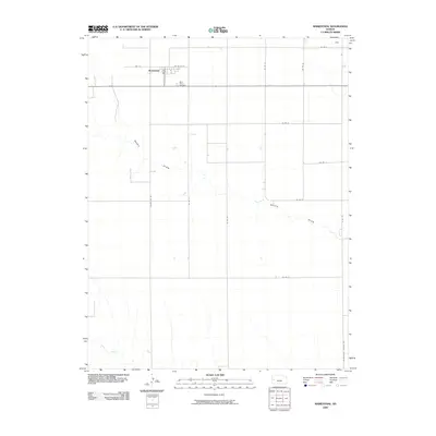
2009 Map of Marienthal
USGS Topo · Published 2009About this map
Marienthal serves as a focal point in this portion of Wichita County, characterized by its precise grid of rural roads and the drainage patterns of the western Kansas plains. The settlement shows a localized street network including 2nd St, 3rd St, and A St, indicating a concentrated pocket of activity within the surrounding agricultural landscape. South of the main cluster lies Saint Marys Cemetery, a significant landmark for those tracing local family histories in Leoti Township. The terrain is defined by the ephemeral flows of White Woman Creek and the meandering path of Rocky Draw, which cut through the section lines. This 2009 representation also identifies Hess in the northeast and follows the Wichita Scott County Rd, marking the geopolitical boundary of the quadrangle.
Find a feature on this map
21 named features on this map. Tap any name to fly to it.
Don’t see what you’re looking for? This feature index may not catch every label — zoom into the map to look around manually.
Map Details
Editions of this 2009 Marienthal Map
This is the sole edition of this map. No revisions or reprints were ever made.
Other maps of this area

1939 · Pence
USGS Topo · 1:62,500

1941 · Modoc
USGS Topo · 1:62,500

1941 · Pence
USGS Topo · 1:62,500

1951 · Modoc
USGS Topo · 1:62,500

1955 · Scott City
USGS Topo · 1:250,000

1958 · Scott City
USGS Topo · 1:250,000

1968 · Russell Springs 3 SE
USGS Topo · 1:24,000

1970 · Leoti
USGS Topo · 1:24,000

1970 · Lydia
USGS Topo · 1:24,000
1976 · Modoc SW
USGS Topo · 1:24,000