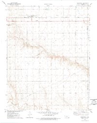
1976 Map of Marienthal
USGS Topo · Published 1978About this map
Marienthal serves as the primary focal point of this High Plains landscape, situated along the Missouri Pacific railroad line. The settlement pattern here is closely tied to the rail corridor and the local agricultural infrastructure, including a Roadside Park and the nearby St Marys Cem. The terrain is defined by the significant incision of Rocky Draw, which carves a deep, winding path through the center of the sheet, eventually meeting the wider drainage of White Woman Creek to the south. This 1976 field-checked survey highlights a transition between the flat upland plains and the more complex drainage systems of the Leoti and Valley townships. Economic activity is represented by scattered Gravel Pits and a long-distance Pipeline that traverses the southern half of the quadrangle.
Find a feature on this map
13 named features on this map. Tap any name to fly to it.
Don’t see what you’re looking for? This feature index may not catch every label — zoom into the map to look around manually.
Map Details
Editions of this 1976 Marienthal Map
This is the sole edition of this map. No revisions or reprints were ever made.
Other maps of this area

1939 · Pence
USGS Topo · 1:62,500

1941 · Modoc
USGS Topo · 1:62,500

1941 · Pence
USGS Topo · 1:62,500

1951 · Modoc
USGS Topo · 1:62,500

1955 · Scott City
USGS Topo · 1:250,000

1958 · Scott City
USGS Topo · 1:250,000

1968 · Russell Springs 3 SE
USGS Topo · 1:24,000

1970 · Leoti
USGS Topo · 1:24,000

1970 · Lydia
USGS Topo · 1:24,000
1976 · Modoc SW
USGS Topo · 1:24,000