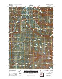
2011 Map of Marion Forks
USGS Topo · Published 2011About this map
Marion Forks serves as the primary human settlement in this high-altitude landscape, situated where the North Santiam River meets multiple descending mountain creeks. The 2011 survey reveals an intricate network of forest access routes like Bingham Ridge RD and Big Meadows RD, which facilitate entry into a terrain defined by dramatic verticality and water features. Prominent landmarks such as Independence Rock and the elevations of Marion Mountain and Turpentine Peak surround a dense collection of alpine basins. These basins contain numerous named bodies of water, including Cleo Lake, Temple Lake, and Pinet Lake. Near Marion Flats, the presence of Camp Pioneer underscores the area's use for recreation and youth programs. The drainage systems are marked by significant cascades, specifically Gooch Falls, Gatch Falls, and Marion Falls, illustrating the steep descent of the local hydrology toward the river valley.
Find a feature on this map
56 named features on this map. Tap any name to fly to it.
Don’t see what you’re looking for? This feature index may not catch every label — zoom into the map to look around manually.
Map Details
Editions of this 2011 Marion Forks Map
This is the sole edition of this map. No revisions or reprints were ever made.
Other maps of this area

1927 · Mt. Jefferson
USGS Topo · 1:125,000

1929 · Mill City
USGS Topo · 1:125,000

1929 · Three Sisters
USGS Topo · 1:125,000

1930 · Mt. Jefferson
USGS Topo · 1:125,000

1932 · Three Sisters
USGS Topo · 1:125,000

1934 · Mc Kenzie Bridge
USGS Topo · 1:96,000

1940 · Mc Kenzie Bridge
USGS Topo · 1:125,000

1953 · Salem
USGS Topo · 1:250,000

1954 · Salem
USGS Topo · 1:250,000

1955 · Echo Mountain
USGS Topo · 1:62,500