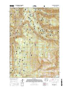
2017 Map of Marion Forks
USGS Topo · Published 2017About this map
Marion Forks serves as the primary human settlement in this high-elevation landscape within the Willamette National Forest. The geography is defined by a dense network of alpine water bodies and drainage systems, most notably Marion Lake and the N Santiam River. Elevation changes are dramatic, anchored by peaks such as Marion Mountain and Turpentine Peak, while water cascades through the terrain at Gooch Falls and Marion Falls. The map reveals an extensive system of forest service roads, including the Turpentine Loop and Big Meadows Rd, which provide access to the remote backcountry and family-named landmarks like Independence Rock. This 2017 survey details a wilderness structured by recreational access and natural resource management, where numerous small lakes like Pinet Lake and Temple Lake dot the basins between Bingham Ridge and Lizard Ridge.
Find a feature on this map
80 named features on this map. Tap any name to fly to it.
Don’t see what you’re looking for? This feature index may not catch every label — zoom into the map to look around manually.
Map Details
Editions of this 2017 Marion Forks Map
This is the sole edition of this map. No revisions or reprints were ever made.
Other maps of this area

1927 · Mt. Jefferson
USGS Topo · 1:125,000

1929 · Mill City
USGS Topo · 1:125,000

1929 · Three Sisters
USGS Topo · 1:125,000

1930 · Mt. Jefferson
USGS Topo · 1:125,000

1932 · Three Sisters
USGS Topo · 1:125,000

1934 · Mc Kenzie Bridge
USGS Topo · 1:96,000

1940 · Mc Kenzie Bridge
USGS Topo · 1:125,000

1953 · Salem
USGS Topo · 1:250,000

1954 · Salem
USGS Topo · 1:250,000

1955 · Echo Mountain
USGS Topo · 1:62,500