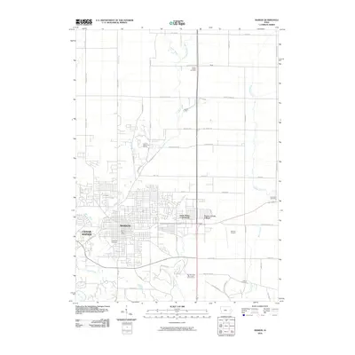
2010 Map of Marion
USGS Topo · Published 2010About this map
Marion and the northeastern edges of Cedar Rapids define the landscape of this 2010 survey, showcasing the continued growth of these Iowa communities. The suburban expansion is balanced by established local landmarks such as the Marion Post Office and the Marion Airport on the eastern edge of town. To the north and east, the map transitions into a more rural character, where family and community history is preserved at Prairie Chapel Cemetery, Oakshade Cemetery, and Crabapple Cemetery. The hydrological network is well-defined by the winding paths of Indian Creek and Squaw Creek, which are flanked by modern developments like the Eagle Ridge Community and the Squaw Creek Municipal Golf Course. This record documents the spatial layout of the region before further 21st-century residential intensification, capturing the specific street grids and outlying rural roads that connect these settlements.
Find a feature on this map
59 named features on this map. Tap any name to fly to it.
Don’t see what you’re looking for? This feature index may not catch every label — zoom into the map to look around manually.
Map Details
Editions of this 2010 Marion Map
This is the sole edition of this map. No revisions or reprints were ever made.
Other maps of this area

1887 · Cedar Rapids
USGS Topo · 1:62,500

1888 · Marion
USGS Topo · 1:62,500

1889 · Marion
USGS Topo · 1:62,500

1890 · Anamosa
USGS Topo · 1:62,500

1891 · Mechanicsville
USGS Topo · 1:62,500

1891 · Cedar Rapids
USGS Topo · 1:62,500

1894 · Mechanicsville
USGS Topo · 1:62,500

1900 · Anamosa
USGS Topo · 1:125,000

1901 · Stanwood
USGS Topo · 1:125,000

1903 · Fairfax
USGS Topo · 1:125,000