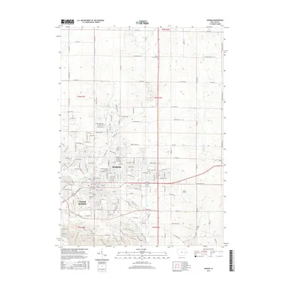
2015 Map of Marion
USGS Topo · Published 2015About this map
Marion and the northeastern edges of Cedar Rapids are shown here as they appeared in 2015, revealing a landscape of suburban expansion meeting rural Linn County heritage. The map traces the winding paths of several waterways, including Indian Creek, Squaw Creek, and Berrys Run, which break up the geometric grid of residential development. Rural history is preserved in localized landmarks such as Prairie Chapel and its associated Prairie Chapel Cemetery, alongside other resting places like Crabapple Cemetery and Martin Cemetery. In the southeastern portion, the Marion Airport stands near Crabapple Creek, while major local corridors like Marion Boulevard and 1st Avenue East connect the two urban centers. This survey captures a moment of modern transition, where large infrastructure like the Marion Airport and commercial districts sit just minutes away from quiet cemeteries and established creek valleys.
Find a feature on this map
117 named features on this map. Tap any name to fly to it.
Don’t see what you’re looking for? This feature index may not catch every label — zoom into the map to look around manually.
Map Details
Editions of this 2015 Marion Map
This is the sole edition of this map. No revisions or reprints were ever made.
Other maps of this area

1887 · Cedar Rapids
USGS Topo · 1:62,500

1888 · Marion
USGS Topo · 1:62,500

1889 · Marion
USGS Topo · 1:62,500

1890 · Anamosa
USGS Topo · 1:62,500

1891 · Mechanicsville
USGS Topo · 1:62,500

1891 · Cedar Rapids
USGS Topo · 1:62,500

1894 · Mechanicsville
USGS Topo · 1:62,500

1900 · Anamosa
USGS Topo · 1:125,000

1901 · Stanwood
USGS Topo · 1:125,000

1903 · Fairfax
USGS Topo · 1:125,000