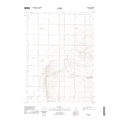
2020 Map of Marion SE
USGS Topo · Published 2020About this map
Oakley sits at the southwestern edge of this landscape, where the flat agricultural basin meets the rising slopes of the Albion Mountains. The land is defined by a transition from irrigated farm plots, served by the E Canal, to the drainage networks of Mill Cr and Land Cr. High-elevation water sources like Land Ranch Spring and Bedke Spring suggest the importance of seasonal grazing and water management in this high-desert environment. The eastern portion of the map is dominated by the steep topography of Big Cedar Canyon and Little Cedar Canyon, illustrating the contrast between the settled valley floor and the surrounding canyons. A network of rural routes, including Pole Line Rd and Land Ranch Rd, provides the primary structure for movement across these township and range divisions.
Find a feature on this map
33 named features on this map. Tap any name to fly to it.
Don’t see what you’re looking for? This feature index may not catch every label — zoom into the map to look around manually.
Map Details
Editions of this 2020 Marion SE Map
This is the sole edition of this map. No revisions or reprints were ever made.
Other maps of this area

1954 · Pocatello
USGS Topo · 1:250,000

1958 · Pocatello
USGS Topo · 1:250,000

1964 · View
USGS Topo · 1:24,000

1964 · Kenyon
USGS Topo · 1:24,000

1964 · Burley Butte
USGS Topo · 1:24,000

1968 · Cache Peak
USGS Topo · 1:24,000

1968 · Basin
USGS Topo · 1:24,000

1968 · Marion SE
USGS Topo · 1:24,000
1968 · Oakley
USGS Topo · 1:24,000

1968 · Mount Harrison
USGS Topo · 1:24,000