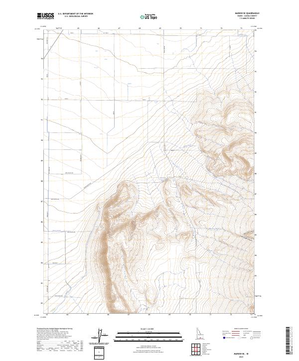
2023 Map of Marion SE
USGS Topo · Published 2023About this map
Land Ranch Spring and Beake Spring emerge from the high desert terrain of southern Idaho, providing critical water sources in a landscape defined by sharp elevation shifts and seasonal drainage. The area's water management is visible through the East Canal, which skirts the western valley floor, contrasting with the natural flow of Willow Creek and Land Creek to the north. Rugged canyons, including Big Cedar Canyon and Little Cedar Canyon, cut deeply into the eastern slopes, while Mackey Wash funnels runoff across the central basin. A rigid grid of rural thoroughfares such as Wilson Ave, Pole Line Rd, and Land Ranch Rd organizes the territory, reflecting the systematic division of land for agricultural and ranching use in this part of Cassia County.
Find a feature on this map
32 named features on this map. Tap any name to fly to it.
Don’t see what you’re looking for? This feature index may not catch every label — zoom into the map to look around manually.
Map Details
Editions of this 2023 Marion SE Map
This is the sole edition of this map. No revisions or reprints were ever made.
Other maps of this area

1954 · Pocatello
USGS Topo · 1:250,000

1958 · Pocatello
USGS Topo · 1:250,000

1964 · View
USGS Topo · 1:24,000

1964 · Kenyon
USGS Topo · 1:24,000

1964 · Burley Butte
USGS Topo · 1:24,000

1968 · Cache Peak
USGS Topo · 1:24,000

1968 · Basin
USGS Topo · 1:24,000

1968 · Marion SE
USGS Topo · 1:24,000
1968 · Oakley
USGS Topo · 1:24,000

1968 · Mount Harrison
USGS Topo · 1:24,000