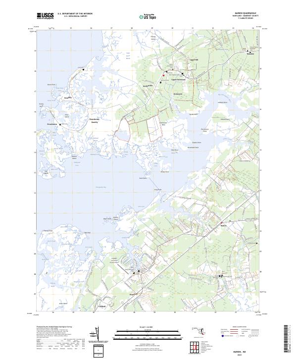
2023 Map of Marion
USGS Topo · Published 2023About this map
Fairmount Neck and the surrounding Chesapeake Bay tidewater define this portrait of coastal Somerset County. The landscape is a complex network of marshes and coves, where land and water merge at Jericho Marsh and Acre Marsh. Settlement is concentrated in small, historic clusters such as Landonville, Upper Fairmount, and Rumbley, many of which are situated along narrow necks of land. The prevalence of family and community burial grounds, including Union Cem and the Samuel Wesley Methodist Cem, points to deep-rooted local lineages in this maritime environment.
Find a feature on this map
145 named features on this map. Tap any name to fly to it.
Don’t see what you’re looking for? This feature index may not catch every label — zoom into the map to look around manually.
Map Details
Editions of this 2023 Marion Map
This is the sole edition of this map. No revisions or reprints were ever made.
Other maps of this area

1903 · Crisfield
USGS Topo · 1:62,500

1903 · Deal Island
USGS Topo · 1:62,500

1920 · Crisfield
USGS Topo · 1:62,500

1942 · Terrapin Sand Point
USGS Topo · 1:24,000

1942 · Great Fox Island
USGS Topo · 1:24,000

1942 · Marion
USGS Topo · 1:24,000

1942 · Deal Island
USGS Topo · 1:24,000

1942 · Monie
USGS Topo · 1:24,000

1942 · Kingston
USGS Topo · 1:24,000

1942 · Princess Anne
USGS Topo · 1:24,000