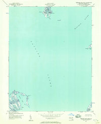
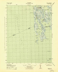
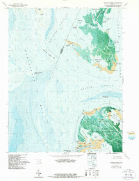
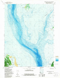
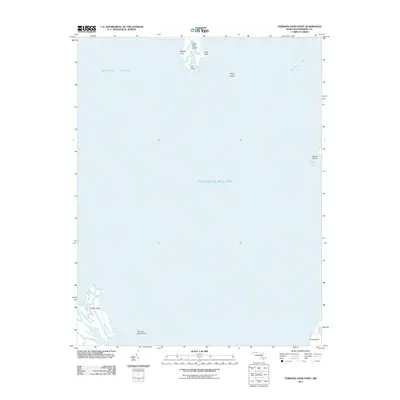
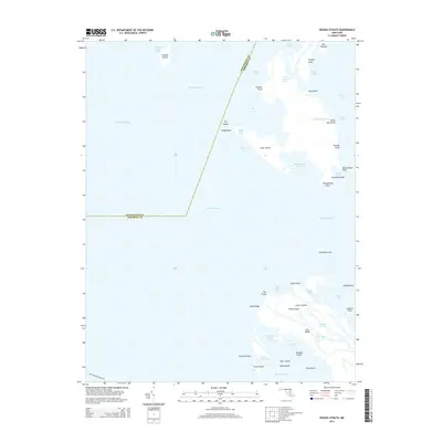
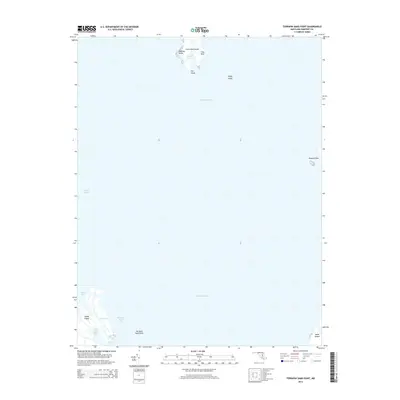
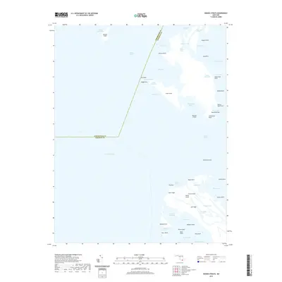
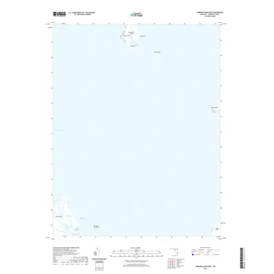
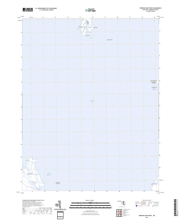
1942 Map of Terrapin Sand Point
USGS Topo · Published 1957About this map
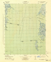
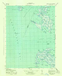
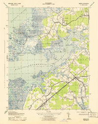
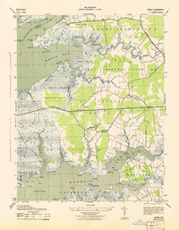
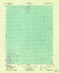
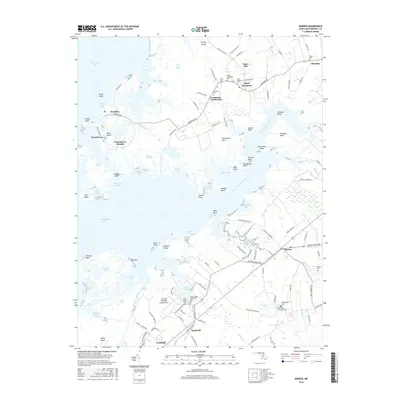
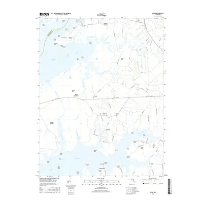
Tangier Sound dominates this mid-century maritime study, serving as the central waterway between fragmented island chains and the mainland of Somerset County. To the south, the northern tip of Smith Island reveals an intricate network of tidal guts including Joes Ridge Creek and Otter Creek, where the land yields to the expansive Terrapin Sand Cove. This topography highlights the precarious nature of the Chesapeake marshes, where named landings like Barnes Landing represent vital connection points for isolated waterman communities.
Find a feature on this map
21 named features on this map. Tap any name to fly to it.
Don’t see what you’re looking for? This feature index may not catch every label — zoom into the map to look around manually.
Map Details
Editions of this 1942 Terrapin Sand Point Map
This is the sole edition of this map. No revisions or reprints were ever made.
Historical Maps of Somerset County Through Time
49 maps found
1942 Great Fox Island
Somerset County, MD
1942 Kedges Straits
Somerset County, MD

1942 Kingston
Somerset County, MD
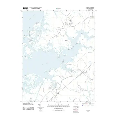
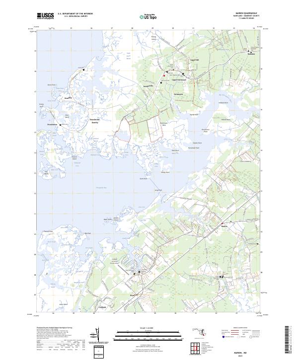
1942 Marion
Somerset County, MD

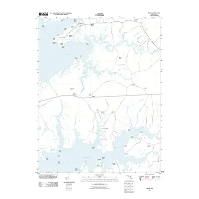
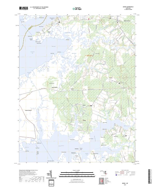
1942 Monie
Somerset County, MD
1942 Terrapin Sand Point
Somerset County, MD
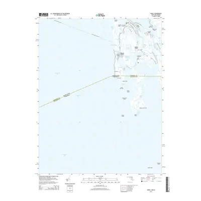
1943 Ewell
Somerset County, MD
1943 Great Fox Island
Somerset County, MD
1943 Kedges Straits
Somerset County, MD
1943 Kingston
Somerset County, MD
1943 Marion
Somerset County, MD
1943 Monie
Somerset County, MD
1943 Terrapin Sand Point
Somerset County, MD
1968 Ewell
Somerset County, MD
1972 Kedges Straits
Somerset County, MD
1972 Kingston
Somerset County, MD
1972 Marion
Somerset County, MD
1972 Monie
Somerset County, MD
1973 Terrapin Sand Point
Somerset County, MD
2011 Ewell
Somerset County, MD
2011 Kedges Straits
Somerset County, MD
2011 Kingston
Somerset County, MD
2011 Marion
Somerset County, MD
2011 Monie
Somerset County, MD
2011 Terrapin Sand Point
Somerset County, MD
2014 Ewell
Somerset County, MD
2014 Kedges Straits
Somerset County, MD
2014 Kingston
Somerset County, MD
2014 Marion
Somerset County, MD
2014 Monie
Somerset County, MD
2014 Terrapin Sand Point
Somerset County, MD
2016 Ewell
Somerset County, MD
2016 Kedges Straits
Somerset County, MD
2016 Kingston
Somerset County, MD
2016 Marion
Somerset County, MD
2016 Monie
Somerset County, MD
2017 Terrapin Sand Point
Somerset County, MD
2019 Ewell
Somerset County, MD
2019 Kedges Straits
Somerset County, MD
2019 Kingston
Somerset County, MD
2019 Marion
Somerset County, MD
2019 Monie
Somerset County, MD
2019 Terrapin Sand Point
Somerset County, MD
2023 Ewell
Somerset County, MD
2023 Kedges Straits
Somerset County, MD
2023 Kingston
Somerset County, MD
2023 Marion
Somerset County, MD
2023 Monie
Somerset County, MD
2023 Terrapin Sand Point
Somerset County, MD