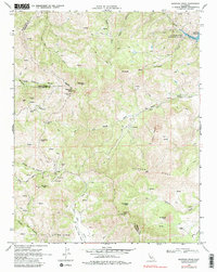
1969 Map of Mariposa Peak
USGS Topo · Published 1982About this map
The high ridges of the Diablo Range dominate this landscape at the intersection of Merced, San Benito, and Santa Clara counties. Industrial activity is concentrated in the western highlands, marked by the Stayton Mine, Ambrose Mine, and Mariposa Mine near the summit of Mariposa Peak. These sites, along with a Quarry and Gravel Pit, speak to the mineral extraction history of the region. The map reveals a network of water sources, from the San Luis Reservoir in the northeast to numerous isolated points labeled Spring, which were vital for the remote livestock operations at Frenchs Ranch and Pfeiffer Ranch.
Find a feature on this map
46 named features on this map. Tap any name to fly to it.
Don’t see what you’re looking for? This feature index may not catch every label — zoom into the map to look around manually.
Map Details
Editions of this 1969 Mariposa Peak Map
3 editions found
Other maps of this area

1919 · Hollister
USGS Topo · 1:48,000

1920 · Pacheco Pass
USGS Topo · 1:62,500

1921 · Gilroy Hot Springs
USGS Topo · 1:62,500

1921 · Hollister
USGS Topo · 1:62,500

1922 · Quien Sabe
USGS Topo · 1:62,500

1922 · San Luis Creek
USGS Topo · 1:31,680

1923 · Hollister
USGS Topo · 1:62,500

1939 · Gilroy Hot Springs
USGS Topo · 1:62,500

1940 · Gilroy Hot Springs
USGS Topo · 1:62,500

1940 · Hollister
USGS Topo · 1:62,500