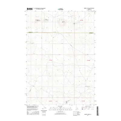
2017 Map of Market Lake NE
USGS Topo · Published 2017About this map
Big Grassy Butte and Gerber Butte rise from the high desert landscape of eastern Idaho, defining a volcanic terrain that spans the border between Jefferson and Fremont Counties. This 2017 U.S. Geological Survey representation documents a transition from the structured township grids to the more complex topography of the Snake River Plain. The elevation gain at Monument Butte and the adjacent Sheepherder peak provides a stark contrast to the surrounding flats. Human activity is marked by a network of long-distance routes, including Egin-Hamer Rd and Hawgood Crossing Rd, which cut through the sagebrush and lava fields. These roads follow the ancient paths of early settlers and cattle drivers, connecting isolated landmarks like Little Grassy Butte and Little Grassy Ridge across the open range.
Find a feature on this map
20 named features on this map. Tap any name to fly to it.
Don’t see what you’re looking for? This feature index may not catch every label — zoom into the map to look around manually.
Map Details
Editions of this 2017 Market Lake NE Map
This is the sole edition of this map. No revisions or reprints were ever made.
Other maps of this area
1951 · Menan Buttes
USGS Topo · 1:24,000

1951 · Plano
USGS Topo · 1:24,000

1955 · Dubois
USGS Topo · 1:250,000

1955 · Idaho Falls
USGS Topo · 1:250,000

1955 · Ashton
USGS Topo · 1:250,000

1955 · Driggs
USGS Topo · 1:250,000

1958 · Driggs
USGS Topo · 1:250,000

1958 · Dubois
USGS Topo · 1:250,000

1958 · Idaho Falls
USGS Topo · 1:250,000

1958 · Ashton
USGS Topo · 1:250,000