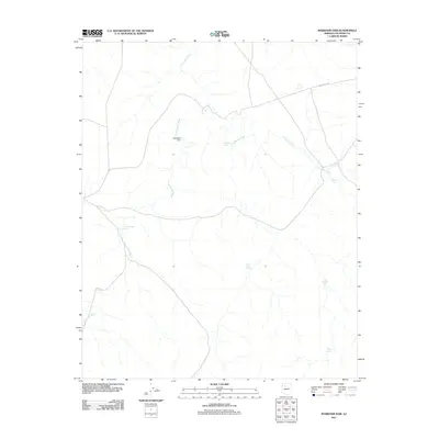
2011 Map of Markham Dam
USGS Topo · Published 2011About this map
Markham Dam and the seasonal drainages of the high desert define this Coconino County landscape during the early 21st century. The terrain is characterized by a complex network of ephemeral waterways, primarily Monument Wash and Cataract Creek, which dictate the placement of local infrastructure. In this arid environment, water management is the primary human footprint, visible through a series of distributed catchments such as Little Rodgers Tanks, Mahan Tank, and Miller Tank. These features suggest a landscape dedicated to cattle ranching or wildlife management rather than dense settlement. The only major named transit corridor is Willaha Co Rd, which cuts across the northern reaches of the quadrangle, providing the principal access through this sparsely populated territory.
Find a feature on this map
11 named features on this map. Tap any name to fly to it.
Don’t see what you’re looking for? This feature index may not catch every label — zoom into the map to look around manually.
Map Details
Editions of this 2011 Markham Dam Map
This is the sole edition of this map. No revisions or reprints were ever made.
Other maps of this area

1886 · Chino
USGS Topo · 1:250,000

1891 · Chino
USGS Topo · 1:250,000

1948 · Williams
USGS Topo · 1:250,000

1954 · Williams
USGS Topo · 1:250,000

1956 · Williams
USGS Topo · 1:250,000

1960 · Williams
USGS Topo · 1:250,000

1961 · Williams
USGS Topo · 1:250,000

1979 · Little Harpo Canyon
USGS Topo · 1:24,000
1979 · Howard Hill
USGS Topo · 1:24,000
1980 · Markham Dam
USGS Topo · 1:24,000