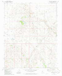
1980 Map of Markham Dam
USGS Topo · Published 1981About this map
Cataract Canyon and its many seasonal watercourses define the high plateau landscape of northern Coconino County. The geography of this area is heavily shaped by cattle ranching and water management, as evidenced by a dense network of catchments and containment structures. Major landmarks include Markham Dam and Perrin Dam, which along with numerous specialized reservoirs like Little Rodgers Tanks and Mahan Tank, supported the pastoral economy of the late 20th century. The intricate drainage patterns of Monument Wash and Brown Dams reveal the complex way water is directed across this arid terrain. This 1980 survey serves as a precise record of these hydrological improvements before modern environmental or land-use changes altered the region's infrastructure.
Find a feature on this map
14 named features on this map. Tap any name to fly to it.
Don’t see what you’re looking for? This feature index may not catch every label — zoom into the map to look around manually.
Map Details
Editions of this 1980 Markham Dam Map
2 editions found
Other maps of this area

1886 · Chino
USGS Topo · 1:250,000

1891 · Chino
USGS Topo · 1:250,000

1948 · Williams
USGS Topo · 1:250,000

1954 · Williams
USGS Topo · 1:250,000

1956 · Williams
USGS Topo · 1:250,000

1960 · Williams
USGS Topo · 1:250,000

1961 · Williams
USGS Topo · 1:250,000

1979 · Little Harpo Canyon
USGS Topo · 1:24,000
1979 · Howard Hill
USGS Topo · 1:24,000
1980 · Tin House
USGS Topo · 1:24,000