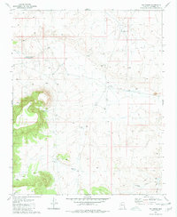
1980 Map of Tin House
USGS Topo · Published 1981About this map
Tin House sits at the center of this high-plateau landscape in Coconino County, characterized by a sophisticated network of water management features essential for ranching in the arid Arizona interior. The terrain is dominated by the prominent elevation of Long Point in the west, which provides a natural anchor for the surrounding draws and washes. Cattle tanks and small reservoirs like Mexican Tank, Paul Moore Tank, and Little Baldy Tank are distributed across the land, tracing the necessities of livestock movement and seasonal water availability. Surface drainage is defined by the Monument Wash and the Farm Dam Draw, where man-made improvements like the Long Point Dam and Flat Dam illustrate the historical effort to capture runoff. This survey, based on 1974 aerial photography, documents the infrastructure of the range before modern developments altered the patterns of these upland grazing lands.
Find a feature on this map
17 named features on this map. Tap any name to fly to it.
Don’t see what you’re looking for? This feature index may not catch every label — zoom into the map to look around manually.
Map Details
Editions of this 1980 Tin House Map
2 editions found
Other maps of this area

1886 · Chino
USGS Topo · 1:250,000

1891 · Chino
USGS Topo · 1:250,000

1948 · Williams
USGS Topo · 1:250,000

1954 · Williams
USGS Topo · 1:250,000

1956 · Williams
USGS Topo · 1:250,000

1960 · Williams
USGS Topo · 1:250,000

1961 · Williams
USGS Topo · 1:250,000

1979 · Little Harpo Canyon
USGS Topo · 1:24,000

1980 · Hazen Hole Tank
USGS Topo · 1:24,000
1980 · Markham Dam
USGS Topo · 1:24,000