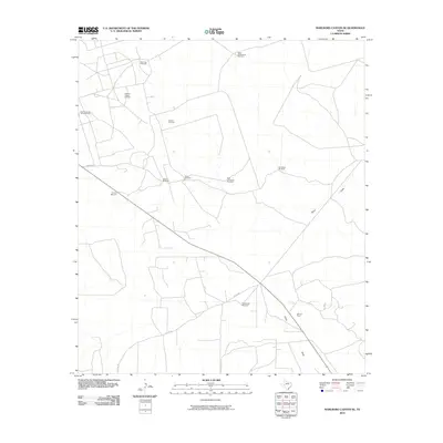
2010 Map of Marlboro Canyon SE
USGS Topo · Published 2010About this map
Amacker Tippett Oil Field and the BFP Oil Field define the industrial footprint of this West Texas landscape during the early 21st century. The terrain is marked by a network of ranching infrastructure, primarily a series of named windmills that provide water to this arid portion of Upton County. These include Buck Trap Windmill, High Lonesome Windmill, and the uniquely named Eighthundred Acre Windmill.
Find a feature on this map
15 named features on this map. Tap any name to fly to it.
Don’t see what you’re looking for? This feature index may not catch every label — zoom into the map to look around manually.
Map Details
Editions of this 2010 Marlboro Canyon SE Map
This is the sole edition of this map. No revisions or reprints were ever made.
Other maps of this area

1928 · Crane
USGS Topo · 1:125,000

1928 · Rankin
USGS Topo · 1:125,000

1954 · Pecos
USGS Topo · 1:250,000

1954 · San Angelo
USGS Topo · 1:250,000

1957 · Pecos
USGS Topo · 1:250,000

1958 · San Angelo
USGS Topo · 1:250,000

1965 · San Angelo
USGS Topo · 1:250,000

1970 · Lindsey Ranch
USGS Topo · 1:24,000

1970 · Sevenmile Corner
USGS Topo · 1:24,000
1970 · Rankin
USGS Topo · 1:24,000