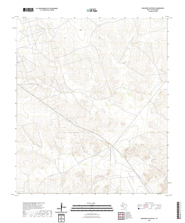
2022 Map of Marlboro Canyon SE
USGS Topo · Published 2022About this map
China Draw cuts a prominent path through the arid landscape of Upton County, defining the drainage patterns for this section of West Texas. The region is largely shaped by its ranching and resource-based infrastructure, with an established network of local routes including Amacker Rd, Ranch Loop Rd, and Co Rd 160. These roads wind through a landscape characterized by sharp elevation changes and dry watercourses, serving as the primary access points for the remote parcels and ranch lands in the area. This 2022 survey provides a precise modern record of the local topography, highlighting how transportation corridors like Co Rd 485 adapt to the natural contours of the West Texas basin.
Find a feature on this map
6 named features on this map. Tap any name to fly to it.
Don’t see what you’re looking for? This feature index may not catch every label — zoom into the map to look around manually.
Map Details
Editions of this 2022 Marlboro Canyon SE Map
This is the sole edition of this map. No revisions or reprints were ever made.
Other maps of this area

1928 · Crane
USGS Topo · 1:125,000

1928 · Rankin
USGS Topo · 1:125,000

1954 · Pecos
USGS Topo · 1:250,000

1954 · San Angelo
USGS Topo · 1:250,000

1957 · Pecos
USGS Topo · 1:250,000

1958 · San Angelo
USGS Topo · 1:250,000

1965 · San Angelo
USGS Topo · 1:250,000

1970 · Lindsey Ranch
USGS Topo · 1:24,000

1970 · Sevenmile Corner
USGS Topo · 1:24,000
1970 · Rankin
USGS Topo · 1:24,000