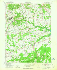
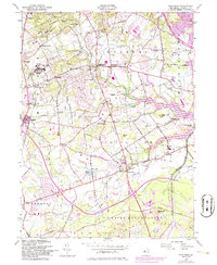
1954 Map of Marlboro
USGS Topo · Published 1964About this map
Marlboro State Hospital dominates the western portion of this mid-century landscape, complete with its own dedicated State Hosp Cem and a complex of service roads and water infrastructure. The terrain transitions from the institutional grounds and the agricultural hamlets of Bradevelt and Wickatunk into the dense military footprint of the U S Naval Reservation Earle Ammunition Depot to the south. This era shows the nascent suburbanization of Monmouth County, where the Garden State Parkway cuts through the northeast, yet the region remains defined by local crossroads and rural traditions.
Find a feature on this map
67 named features on this map. Tap any name to fly to it.
Don’t see what you’re looking for? This feature index may not catch every label — zoom into the map to look around manually.
Map Details
Editions of this 1954 Marlboro Map
5 editions found
Other maps of this area

1888 · New Brunswick
USGS Topo · 1:62,500

1888 · Asbury Park
USGS Topo · 1:62,500

1888 · Cassville
USGS Topo · 1:62,500

1888 · Sandy Hook
USGS Topo · 1:62,500

1893 · New Brunswick
USGS Topo · 1:62,500

1893 · Sandy Hook
USGS Topo · 1:62,500

1893 · Asbury Park
USGS Topo · 1:62,500

1894 · Cassville
USGS Topo · 1:62,500

1900 · Cassville
USGS Topo · 1:62,500

1901 · New Brunswick
USGS Topo · 1:62,500
Featured Places
- Middletown Township, NJ
- Howell Township, NJ
- Marlboro Township, NJ
- Freehold Township, NJ
- Wall Township, NJ