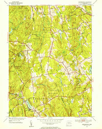
1953 Map of Marlborough
USGS Topo · Published 1954About this map
Marlborough and the surrounding woodlands of central Connecticut are documented here just as post-war suburban development began to reach into the rural Tolland and Hartford county borders. The landscape is dominated by significant public lands, including the Gay City State Park and the extensive Meshomasic State Forest. These protected areas preserved the rugged character of the hills even as local roads like the New Haven and Hartford Road facilitated travel through the region.
Find a feature on this map
80 named features on this map. Tap any name to fly to it.
Don’t see what you’re looking for? This feature index may not catch every label — zoom into the map to look around manually.
Map Details
Editions of this 1953 Marlborough Map
4 editions found
Other maps of this area

1892 · Hartford
USGS Topo · 1:62,500

1892 · Tolland
USGS Topo · 1:62,500

1892 · Gilead
USGS Topo · 1:62,500

1893 · Middletown
USGS Topo · 1:62,500

1906 · Farmington
USGS Topo · 1:125,000

1921 · Tolland
USGS Topo · 1:62,500

1928 · Glastonbury
USGS Topo · 1:24,000

1928 · Manchester
USGS Topo · 1:24,000

1944 · Manchester
USGS Topo · 1:31,680

1944 · Marlboro
USGS Topo · 1:31,680