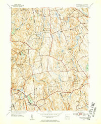
1953 Map of Marlborough
USGS Topo · Published 1954About this map
The town of Marlborough and the surrounding woodlands of eastern Connecticut appear in this mid-century survey, characterized by a transition from traditional rural crossroad settlements to a landscape increasingly defined by state conservation efforts. The area is anchored by significant protected lands, including the Gay City State Park and the expansive Meshomasic State Forest, where the Lookout Tower stands as a prominent high point. These forests are carved by an intricate network of watercourses like Blackledge River and Dickinson Creek, alongside recreation-focused water bodies such as Lake Terramuggus and Diamond Lake.
Find a feature on this map
75 named features on this map. Tap any name to fly to it.
Don’t see what you’re looking for? This feature index may not catch every label — zoom into the map to look around manually.
Map Details
Editions of this 1953 Marlborough Map
4 editions found
Other maps of this area

1892 · Hartford
USGS Topo · 1:62,500

1892 · Tolland
USGS Topo · 1:62,500

1892 · Gilead
USGS Topo · 1:62,500

1893 · Middletown
USGS Topo · 1:62,500

1906 · Farmington
USGS Topo · 1:125,000

1921 · Tolland
USGS Topo · 1:62,500

1928 · Glastonbury
USGS Topo · 1:24,000

1928 · Manchester
USGS Topo · 1:24,000

1944 · Manchester
USGS Topo · 1:31,680

1944 · Marlboro
USGS Topo · 1:31,680