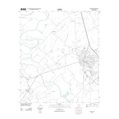
2013 Map of Marlin
USGS Topo · Published 2013About this map
The Brazos River creates a meandering western boundary for this central Texas landscape, where the city of Marlin serves as the primary hub of settlement and industry. Evidence of the local agricultural and water management history is found in features like Barganier Slough, McCullough Slough, and the Falls Cattle Company Lake. The city layout reflects its development around the railroad, with Railroad St and Oil Mill Lake hinting at past commercial processing centers.
Find a feature on this map
127 named features on this map. Tap any name to fly to it.
Don’t see what you’re looking for? This feature index may not catch every label — zoom into the map to look around manually.
Map Details
Editions of this 2013 Marlin Map
This is the sole edition of this map. No revisions or reprints were ever made.
Other maps of this area

1892 · Temple
USGS Topo · 1:125,000

1954 · Waco
USGS Topo · 1:250,000

1955 · Waco
USGS Topo · 1:250,000

1957 · Otto
USGS Topo · 1:24,000

1957 · McClanahan
USGS Topo · 1:24,000

1957 · Riesel
USGS Topo · 1:24,000

1957 · Chilton
USGS Topo · 1:24,000

1957 · Marlin
USGS Topo · 1:24,000
1957 · Robinson
USGS Topo · 1:24,000

1962 · Reagan
USGS Topo · 1:24,000