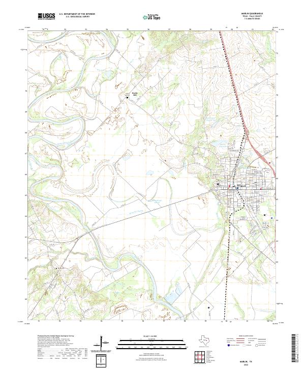
2022 Map of Marlin
USGS Topo · Published 2022About this map
The Brazos River creates a meandering western boundary for the county seat of Marlin, defining a landscape where river bottomlands meet the established street grid of the town. The presence of the Falls County Courthouse and Oil Mill Lake anchors the downtown district, reflecting the civic and industrial history of this Central Texas hub. To the north, the small settlement of Rocky Hill sits near its namesake Rocky Hill Cem, while the surrounding terrain is marked by numerous watercourses including Barganier Slough and McCullough Slough. Genealogists can trace local burial sites such as Marlin Calvary Cem and Beulah Cem, while the network of county roads like Old Belton Rd and Rolling Hills Rd shows the modern connectivity of this agricultural and residential region.
Find a feature on this map
107 named features on this map. Tap any name to fly to it.
Don’t see what you’re looking for? This feature index may not catch every label — zoom into the map to look around manually.
Map Details
Editions of this 2022 Marlin Map
This is the sole edition of this map. No revisions or reprints were ever made.
Other maps of this area

1892 · Temple
USGS Topo · 1:125,000

1954 · Waco
USGS Topo · 1:250,000

1955 · Waco
USGS Topo · 1:250,000

1957 · Otto
USGS Topo · 1:24,000

1957 · McClanahan
USGS Topo · 1:24,000

1957 · Riesel
USGS Topo · 1:24,000

1957 · Chilton
USGS Topo · 1:24,000

1957 · Marlin
USGS Topo · 1:24,000
1957 · Robinson
USGS Topo · 1:24,000

1962 · Reagan
USGS Topo · 1:24,000