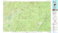
1979 Map of Marlinton
USGS Topo · Published 1982About this map
Marlinton and Summersville serve as major hubs in this late 1970s topographical survey of the Allegheny Mountains region. The landscape is defined by the high ridges of Yew Mountain and Black Mountain, which overlook a complex network of waterways including the Gauley River, Williams River, and Cranberry River. The mapping of the Monongahela National Forest reveals a territory where conservation and heavy industry meet, with the tracks of the Baltimore and Ohio and Chesapeake and Ohio railroads traversing the valleys to serve coal and timber settlements like Richwood, Quinwood, and Rainelle. Cultural landmarks are scattered throughout the highlands, from the Nicholas County High Sch to local landmarks like Lookout Tower. Several state parks preserve the area's history and natural features, most notably Droop Mountain Battlefield State Park and Carnifex Ferry Battlefield State Park, marking significant Civil War sites within the mountain terrain.
Find a feature on this map
158 named features on this map. Tap any name to fly to it.
Don’t see what you’re looking for? This feature index may not catch every label — zoom into the map to look around manually.
Map Details
Editions of this 1979 Marlinton Map
This is the sole edition of this map. No revisions or reprints were ever made.
Other maps of this area

1887 · Hinton
USGS Topo · 1:125,000

1887 · Lewisburg
USGS Topo · 1:125,000

1889 · Nicholas
USGS Topo · 1:125,000

1889 · Beverly
USGS Topo · 1:125,000

1891 · Lewisburg
USGS Topo · 1:125,000

1891 · Nicholas
USGS Topo · 1:125,000

1891 · Huntersville
USGS Topo · 1:125,000

1891 · Raleigh
USGS Topo · 1:125,000

1892 · Beverly
USGS Topo · 1:125,000

1892 · Hinton
USGS Topo · 1:125,000