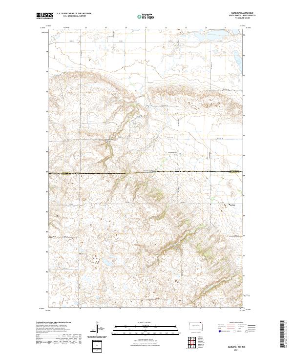
2021 Map of Marlow
USGS Topo · Published 2021About this map
The Coteau des Prairies, a massive plateau of glacial deposit, dominates the topography of this borderland between Sargent County, North Dakota, and Marshall County, South Dakota. This high ground rises sharply from the surrounding plains, influencing the drainage patterns of small water bodies like Quant Slough and White Lake in the north, while La Belle Cr winds through the southern reaches. The landscape is characterized by a sparse, rural settlement pattern typical of the eastern Dakotas, centered around the community of Marlow. Historically significant sites like the Immanuel Cem are found near the state line, serving as silent markers of the early families who homesteaded these prairie heights. The map details a precise grid of local roads, such as Co RD 5 and Co HWY 2, which negotiate the elevation changes of the plateau.
Find a feature on this map
30 named features on this map. Tap any name to fly to it.
Don’t see what you’re looking for? This feature index may not catch every label — zoom into the map to look around manually.
Map Details
Editions of this 2021 Marlow Map
This is the sole edition of this map. No revisions or reprints were ever made.
Other maps of this area

1907 · Wyndmere
USGS Topo · 1:125,000

1953 · Milbank
USGS Topo · 1:250,000

1953 · Fargo
USGS Topo · 1:250,000

1954 · Kidder SE
USGS Topo · 1:24,000

1956 · Fargo
USGS Topo · 1:250,000

1956 · Havana
USGS Topo · 1:24,000

1958 · Milbank
USGS Topo · 1:250,000

1958 · Hillhead
USGS Topo · 1:24,000

1958 · Veblen
USGS Topo · 1:24,000

1958 · Marlow
USGS Topo · 1:24,000