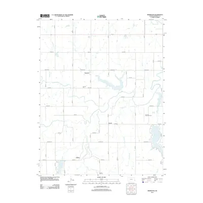
2012 Map of Marmaton
USGS Topo · Published 2012About this map
The Marmaton River and its numerous tributaries, including Paint Cr, Pawnee Cr, and Cedar Cr, define the drainage and settlement patterns of this Bourbon County landscape. The small community of Marmaton is situated near the river's northern bend, accompanied by the local Marmaton Cem. Further south, the map details the rural settlements of Ronald and Hollister, the latter positioned near the headwaters of Elm Cr.
Find a feature on this map
45 named features on this map. Tap any name to fly to it.
Don’t see what you’re looking for? This feature index may not catch every label — zoom into the map to look around manually.
Map Details
Editions of this 2012 Marmaton Map
This is the sole edition of this map. No revisions or reprints were ever made.
Other maps of this area

1884 · Fort Scott
USGS Topo · 1:125,000

1886 · Fort Scott
USGS Topo · 1:125,000

1893 · Fort Scott
USGS Topo · 1:125,000

1947 · Joplin
USGS Topo · 1:250,000

1948 · Mulberry
USGS Topo · 1:62,500

1948 · Girard
USGS Topo · 1:62,500
1949 · Girard
USGS Topo · 1:62,500

1949 · Joplin
USGS Topo · 1:250,000
1950 · Mulberry
USGS Topo · 1:62,500

1954 · Joplin
USGS Topo · 1:250,000