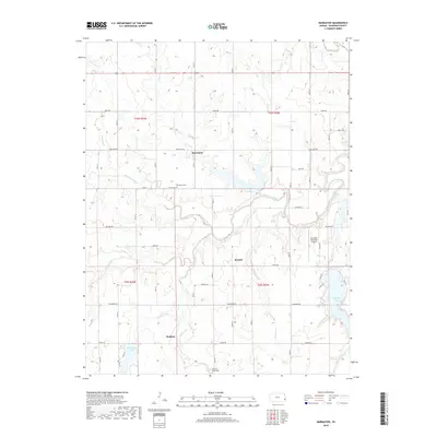
2018 Map of Marmaton
USGS Topo · Published 2018About this map
The Marmaton River and its intricate drainage network define this Bourbon County landscape, where the settlements of Marmaton, Ronald, and Hollister serve as local anchors. This 2018 survey illustrates a rural terrain deeply tied to its watercourses, featuring Paint Creek, Pawnee Cr, and the smaller Chambers Br. The presence of several established cemeteries, including Marmaton Cem and Pleasant Valley Cem, provides significant touchpoints for genealogical research in this part of eastern Kansas.
Find a feature on this map
53 named features on this map. Tap any name to fly to it.
Don’t see what you’re looking for? This feature index may not catch every label — zoom into the map to look around manually.
Map Details
Editions of this 2018 Marmaton Map
This is the sole edition of this map. No revisions or reprints were ever made.
Other maps of this area

1884 · Fort Scott
USGS Topo · 1:125,000

1886 · Fort Scott
USGS Topo · 1:125,000

1893 · Fort Scott
USGS Topo · 1:125,000

1947 · Joplin
USGS Topo · 1:250,000

1948 · Mulberry
USGS Topo · 1:62,500

1948 · Girard
USGS Topo · 1:62,500
1949 · Girard
USGS Topo · 1:62,500

1949 · Joplin
USGS Topo · 1:250,000
1950 · Mulberry
USGS Topo · 1:62,500

1954 · Joplin
USGS Topo · 1:250,000