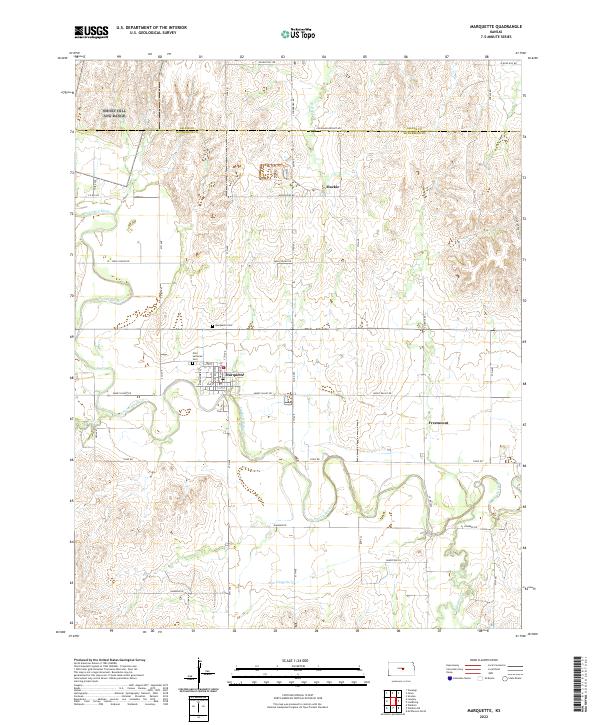
2022 Map of Marquette
USGS Topo · Published 2022About this map
Marquette serves as the primary hub of this central Kansas landscape, situated along the meandering path of the Smoky Hill River. The river valley is the defining geographic feature, with several tributaries such as Wolf Cr and Edwards Cr draining into the main channel from the surrounding uplands. Evidence of the area's Swedish-American heritage and early settlement patterns is preserved in the location of the Elim Lutheran Cem and the nearby Freemount community, while the Marquette Cem sits on the higher ground north of the town site.
Find a feature on this map
28 named features on this map. Tap any name to fly to it.
Don’t see what you’re looking for? This feature index may not catch every label — zoom into the map to look around manually.
Map Details
Editions of this 2022 Marquette Map
This is the sole edition of this map. No revisions or reprints were ever made.
Other maps of this area

1891 · Hutchinson
USGS Topo · 1:125,000

1892 · Salina
USGS Topo · 1:125,000

1893 · Hutchinson
USGS Topo · 1:125,000

1942 · Salina
USGS Topo · 1:125,000

1955 · Smolan
USGS Topo · 1:24,000

1955 · Falun
USGS Topo · 1:24,000

1955 · Hutchinson
USGS Topo · 1:250,000
1957 · Venango
USGS Topo · 1:24,000

1959 · Hutchinson
USGS Topo · 1:250,000

1964 · Marquette
USGS Topo · 1:24,000