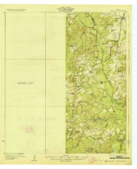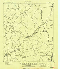
1930 Map of Marquez
USGS Topo · Published 1930About this map
The Navasota River forms the natural boundary between Robertson and Leon counties on this early twentieth-century tactical survey. The International and Great Northern Railway serves as the primary corridor for commerce and settlement, anchoring communities like Franklin P.O., New Baden P.O., and Easterly P.O. along its track. This era reveals a rural landscape defined by small neighborhood centers, many identified by their local post offices or community institutions like Coles Branch School and Holly Church.
Find a feature on this map
45 named features on this map. Tap any name to fly to it.
Don’t see what you’re looking for? This feature index may not catch every label — zoom into the map to look around manually.
Map Details
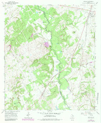
Editions of this 1930 Marquez Map
This is the sole edition of this map. No revisions or reprints were ever made.
Historical Maps of Franklin Through Time
8 maps found