
2024 Map of Mars Hill
USGS Topo · Published 2024About this map
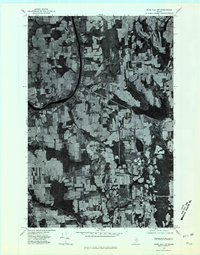
Mars Hill rises prominently above the surrounding agricultural landscape of eastern Aroostook County, serving as a landmark for the adjacent settlements of Mars Hill and Blaine. This modern topographic study reveals a terrain shaped by water, with Prestile Stream and River de Chute winding through the lowlands alongside numerous water bodies such as McPherson Lake, Brown Lake, and Safford Pond. The map documents the international border with Canada to the east and the local infrastructure supporting these rural communities. Researchers will find interest in the documented locations of Kings Grove Cem and Pierce Cem, which sit alongside historic road corridors like Military Rd and Fort St. The layout of the area reflects a deep-rooted connection between the highland topography and the network of local roads that serve the outlying farms and the Mars Hill Airport.
Find a feature on this map
54 named features on this map. Tap any name to fly to it.
Don’t see what you’re looking for? This feature index may not catch every label — zoom into the map to look around manually.
Map Details
Editions of this 2024 Mars Hill Map
This is the sole edition of this map. No revisions or reprints were ever made.
Other maps of this area

1934 · Bridgewater
USGS Topo · 1:48,000

1936 · Mars Hill
USGS Topo · 1:48,000

1938 · Bridgewater
USGS Topo · 1:62,500

1940 · Mars Hill
USGS Topo · 1:62,500

1951 · Mars Hill
USGS Topo · 1:62,500

1951 · Bridgewater
USGS Topo · 1:62,500

1953 · Bridgewater
USGS Topo · 1:50,000

1959 · Woodstock
USGS Topo · 1:250,000

1963 · Woodstock
USGS Topo · 1:250,000
1975 · Mars Hill NW
USGS Topo · 1:24,000