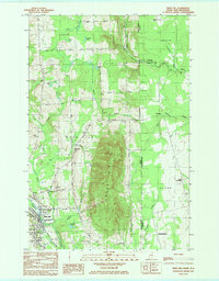
1984 Map of Mars Hill
USGS Topo · Published 1985About this map
The prominent ridge of Mars Hill dominates this 1980s landscape on the international border between Maine and New Brunswick. The twin settlements of Mars Hill and Blaine serve as the local anchors, centered on the Bangor And Aroostook railroad line and the flowing Prestile Stream. This era shows a community well-served by civic and religious institutions, including St Anns Ch, St Josephs Ch, and the Aroostook Medical Center.
Find a feature on this map
80 named features on this map. Tap any name to fly to it.
Don’t see what you’re looking for? This feature index may not catch every label — zoom into the map to look around manually.
Map Details
Editions of this 1984 Mars Hill Map
This is the sole edition of this map. No revisions or reprints were ever made.
Other maps of this area

1934 · Bridgewater
USGS Topo · 1:48,000

1936 · Mars Hill
USGS Topo · 1:48,000

1938 · Bridgewater
USGS Topo · 1:62,500

1940 · Mars Hill
USGS Topo · 1:62,500

1951 · Mars Hill
USGS Topo · 1:62,500

1951 · Bridgewater
USGS Topo · 1:62,500

1953 · Bridgewater
USGS Topo · 1:50,000

1959 · Woodstock
USGS Topo · 1:250,000

1963 · Woodstock
USGS Topo · 1:250,000
1975 · Mars Hill NW
USGS Topo · 1:24,000