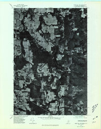
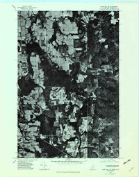
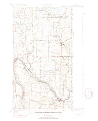
1975 Map of Mars Hill NE
USGS Topo · Published 1981About this map
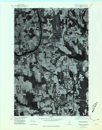
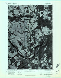
The agricultural landscape of Aroostook County is revealed in this 1975 orthophotoquad, showcasing the distinct checkerboard pattern of potato fields and timbered tracts near the Canadian border. Small rural clusters and transportation hubs like Maple Grove and Fairmount anchor the western portion of the sheet, while the terrain transitions into more heavily wooded land to the east. The presence of Monson Pond provides a central landmark amidst the varied topography of this borderland region. In the south, settlements such as Easton Center and Dover Hill reflect the established rural infrastructure of the mid-1970s. This aerial perspective, prepared by the Geological Survey, offers a clear view of land use and road networks before modern development, including the cross-border proximity of Beaconsfield.
Find a feature on this map
6 named features on this map. Tap any name to fly to it.
Don’t see what you’re looking for? This feature index may not catch every label — zoom into the map to look around manually.
Map Details
Editions of this 1975 Mars Hill NE Map
2 editions found
Other maps of this area

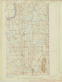
1930 · Fort Fairfield
USGS Topo · 1:48,000

1933 · Fort Fairfield
USGS Topo · 1:62,500

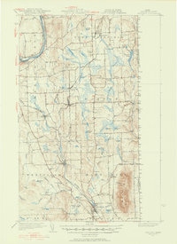
1936 · Mars Hill
USGS Topo · 1:48,000
1940 · Mars Hill
USGS Topo · 1:62,500
1951 · Mars Hill
USGS Topo · 1:62,500
1951 · Fort Fairfield
USGS Topo · 1:62,500

1959 · Woodstock
USGS Topo · 1:250,000

1963 · Woodstock
USGS Topo · 1:250,000
1975 · Mars Hill NW
USGS Topo · 1:24,000
1975 · Fort Fairfield SE
USGS Topo · 1:24,000