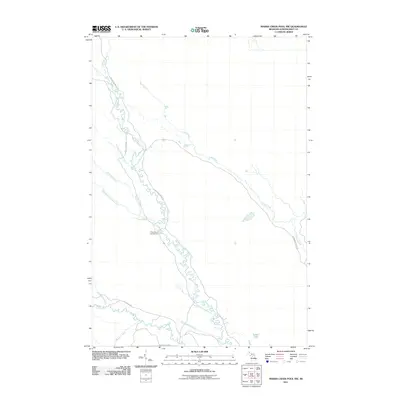
2011 Map of Marsh Creek Pool NW
USGS Topo · Published 2011About this map
The West Branch Manistique River winds through this section of the Upper Peninsula, creating a complex network of wetlands and tributaries. The landscape is defined by its extensive water systems, including the Creighton River, Duck Creek, and Section Nineteen Creek. Human activity is primarily limited to resource management and recreation, evidenced by a series of primitive access routes such as the Highwater Truck Trl, Creighton Truck Trl, and Hickey Truck Trl. Near the center of the sheet, the West Branch Campground provides a point of interest for those tracking development in this wooded terrain. To the south, the presence of Tucker Lake and named drainages like Grindstone Creek and Butts Creek suggest a region shaped by seasonal hydrology and timber management infrastructure.
Find a feature on this map
18 named features on this map. Tap any name to fly to it.
Don’t see what you’re looking for? This feature index may not catch every label — zoom into the map to look around manually.
Map Details
Editions of this 2011 Marsh Creek Pool NW Map
This is the sole edition of this map. No revisions or reprints were ever made.
Other maps of this area

1931 · Steuben SE
USGS Topo · 1:31,680

1931 · Manistique River NE
USGS Topo · 1:31,680

1931 · Steuben NE
USGS Topo · 1:31,680

1931 · Manistique River SE
USGS Topo · 1:31,680

1931 · Manistique River NW
USGS Topo · 1:31,680

1931 · Shingleton SE
USGS Topo · 1:31,680

1931 · Manistique River SW
USGS Topo · 1:31,680

1931 · Driggs Lake SW
USGS Topo · 1:31,680

1931 · Driggs Lake SE
USGS Topo · 1:31,680

1958 · Shingleton
USGS Topo · 1:62,500