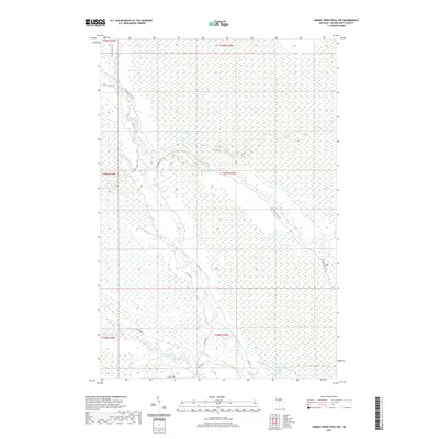
2019 Map of Marsh Creek Pool NW
USGS Topo · Published 2019About this map
The West Branch Manistique River winds through this heavily forested and wetland-rich portion of Schoolcraft County, defining the drainage patterns of the Central Upper Peninsula. This 2019 survey illustrates a landscape primarily managed for timber and conservation, where an extensive network of logging and access routes like the Highwater Truck Trl and Hickey Truck Trl provide the only passage through the dense terrain. These trails trace the higher ground between numerous watercourses, including Stutts Creek and Hiawatha Cr. In the southeastern corner, Tucker Lake and its surrounding marshland mark a significant hydrological focal point. The presence of Co Rd 448 and South Side Rd indicates the sparse but vital infrastructure connecting these timberlands to the larger regional road network, while smaller features like Grindstone Cr and Hay Meadow Cr offer specific landmarks for those tracing the historical hydrography of the Manistique watershed.
Find a feature on this map
28 named features on this map. Tap any name to fly to it.
Don’t see what you’re looking for? This feature index may not catch every label — zoom into the map to look around manually.
Map Details
Editions of this 2019 Marsh Creek Pool NW Map
This is the sole edition of this map. No revisions or reprints were ever made.
Other maps of this area

1931 · Steuben SE
USGS Topo · 1:31,680

1931 · Manistique River NE
USGS Topo · 1:31,680

1931 · Steuben NE
USGS Topo · 1:31,680

1931 · Manistique River SE
USGS Topo · 1:31,680

1931 · Manistique River NW
USGS Topo · 1:31,680

1931 · Shingleton SE
USGS Topo · 1:31,680

1931 · Manistique River SW
USGS Topo · 1:31,680

1931 · Driggs Lake SW
USGS Topo · 1:31,680

1931 · Driggs Lake SE
USGS Topo · 1:31,680

1958 · Shingleton
USGS Topo · 1:62,500