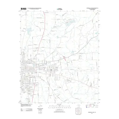
2013 Map of Marshall East
USGS Topo · Published 2013About this map
Harrison County Airport and the eastern fringes of Marshall anchor this detailed geographic study, showing the transition from urban neighborhoods to the resource-rich landscape of East Texas. The region's genealogy is preserved through numerous family and community burial grounds, including Gainesville Cem, Sherrod Cem, and Algoma Cem. To the north, the Woodlawn Gas Field indicates the area's industrial energy history, while residential developments like Jasper Heights and Bel Air illustrate 20th-century growth. The landscape is defined by a network of creeks, such as Deboldin Cr and Eightmile Cr, and significant water bodies like the Lake Shadowood Reservoir. Cultural landmarks such as the Ginochio Historic District reflect the deeper historical roots of this Harrison County seat.
Find a feature on this map
196 named features on this map. Tap any name to fly to it.
Don’t see what you’re looking for? This feature index may not catch every label — zoom into the map to look around manually.
Map Details
Editions of this 2013 Marshall East Map
This is the sole edition of this map. No revisions or reprints were ever made.
Other maps of this area

1943 · Waskom
USGS Topo · 1:62,500

1944 · Caddo Lake
USGS Topo · 1:62,500

1945 · Waskom
USGS Topo · 1:62,500

1946 · Caddo Lake
USGS Topo · 1:62,500

1956 · Tyler
USGS Topo · 1:250,000

1958 · Darco
USGS Topo · 1:62,500

1962 · Marshall NW
USGS Topo · 1:24,000

1962 · Marshall West
USGS Topo · 1:24,000

1962 · Woodlawn
USGS Topo · 1:24,000
1962 · Karnack
USGS Topo · 1:24,000