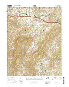
2016 Map of Marshall
USGS Topo · Published 2016About this map
Marshall and The Plains anchor this 2016 survey of the Piedmont region in Fauquier County, where the landscape is defined by a series of prominent ridges and established equestrian estates. The high ground of Wildcat Mtn and the Watery Mountains rises steeply above the valley floors, providing a natural boundary for the sprawling horse country between Marshall and New Baltimore. Smaller communities such as Bethel, Old Tavern, and Airlie are connected by a network of historic thoroughfares including Winchester Rd and Zulla Rd. Notable local landmarks like the Airlie Airport and The Meadows Airport serve the surrounding rural developments. The drainage patterns of Broad Run and Great Run reflect the complex topography of this area, which has maintained its distinct agricultural and residential character despite the proximity of modern transportation corridors like Interstate 66.
Find a feature on this map
104 named features on this map. Tap any name to fly to it.
Don’t see what you’re looking for? This feature index may not catch every label — zoom into the map to look around manually.
Map Details
Editions of this 2016 Marshall Map
This is the sole edition of this map. No revisions or reprints were ever made.
Other maps of this area

1894 · Warrenton
USGS Topo · 1:125,000

1894 · Warrenton
USGS Topo · 1:62,500

1927 · Remington
USGS Topo · 1:48,000

1930 · Warrenton
USGS Topo · 1:62,500

1933 · Middleburg
USGS Topo · 1:62,500

1943 · Catlett
USGS Topo · 1:62,500

1943 · Thorofare Gap
USGS Topo · 1:24,000

1943 · Orlean
USGS Topo · 1:24,000

1943 · Marshall
USGS Topo · 1:24,000

1943 · Upperville
USGS Topo · 1:24,000