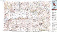
1982 Map of Marshall
USGS Topo · Published 1982About this map
The Missouri River defines the heart of this region, meandering through a landscape shaped by early transportation routes and the confluence of several major tributaries. The historic path of the Santa Fe Trail is marked here, tracing a legacy of westward expansion through the river towns of Lexington and Marshall. The terrain shifts from the flat river bottoms near Baltimore Island to the rising elevations of Montague Hill and Frankfort Hill.
Find a feature on this map
67 named features on this map. Tap any name to fly to it.
Don’t see what you’re looking for? This feature index may not catch every label — zoom into the map to look around manually.
Map Details
Editions of this 1982 Marshall Map
This is the sole edition of this map. No revisions or reprints were ever made.
Other maps of this area

1885 · Warrensburg
USGS Topo · 1:125,000

1887 · Harrisonville
USGS Topo · 1:125,000

1887 · Sedalia
USGS Topo · 1:125,000

1887 · Warrensburg
USGS Topo · 1:125,000

1888 · Boonville
USGS Topo · 1:125,000

1889 · Lexington
USGS Topo · 1:125,000

1890 · Glasgow
USGS Topo · 1:125,000

1890 · Marshall
USGS Topo · 1:125,000

1892 · Marshall
USGS Topo · 1:125,000

1892 · Harrisonville
USGS Topo · 1:125,000