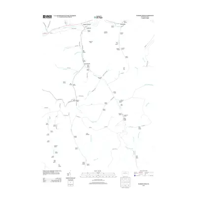
2013 Map of Marshlands
USGS Topo · Published 2013About this map
Pine Cr flows across the northern reach of this Tioga County landscape, connecting the small settlements of Gaines Junction, Waltrous, and Manhattan. The central drainage of Elk Run defines a deep valley system where the village of Marshlands is situated, surrounded by numerous family-named landmarks such as John Smith Hollow and D A Smith Hollow. This 2013 survey illustrates a region where names like Gas Well Hollow point to the local resource economy, while the southern terrain is characterized by the headwaters of Kettle Cr and Big Spring Brook. The nomenclature across the ridges and drafts is particularly evocative, including unusual features like Dead Horse Hollow and Elephant Mountain, providing a detailed record of local geographical identity in the early 21st century.
Find a feature on this map
97 named features on this map. Tap any name to fly to it.
Don’t see what you’re looking for? This feature index may not catch every label — zoom into the map to look around manually.
Map Details
Editions of this 2013 Marshlands Map
This is the sole edition of this map. No revisions or reprints were ever made.
Other maps of this area

1899 · Gaines
USGS Topo · 1:62,500

1900 · Gaines
USGS Topo · 1:62,500

1900 · Elkland
USGS Topo · 1:62,500

1946 · Tiadaghton
USGS Topo · 1:24,000

1946 · Antrim
USGS Topo · 1:62,500

1946 · Cedar Run
USGS Topo · 1:24,000

1947 · Galeton
USGS Topo · 1:62,500

1947 · Lee Fire Tower
USGS Topo · 1:24,000
1947 · Oleona
USGS Topo · 1:24,000

1947 · Galeton
USGS Topo · 1:24,000