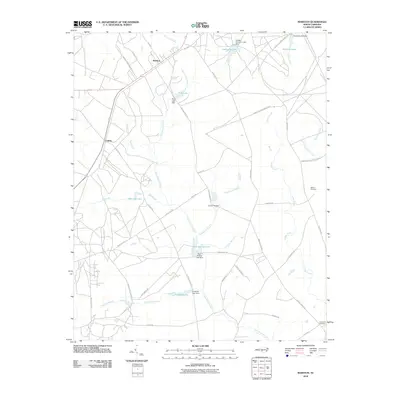
2010 Map of Marston
USGS Topo · Published 2010About this map
Marston and Cognac anchor this portion of Richmond County, where the landscape is defined by an intricate network of managed water bodies and drainage basins. Numerous small dams, including the Laurel Hill Dam and Crawford Lake Dam, have created a series of localized reservoirs such as McLeods Lake and Gum Swamp Lake. These water features feed into several major tributaries like Gum Swamp Creek and Hitchcock Creek, which cut through the terrain.
Find a feature on this map
49 named features on this map. Tap any name to fly to it.
Don’t see what you’re looking for? This feature index may not catch every label — zoom into the map to look around manually.
Map Details
Editions of this 2010 Marston Map
This is the sole edition of this map. No revisions or reprints were ever made.
Other maps of this area

1942 · Troy
USGS Topo · 1:125,000

1942 · Rockingham
USGS Topo · 1:125,000

1948 · Southern Pines
USGS Topo · 1:62,500

1948 · Pinebluff
USGS Topo · 1:24,000

1949 · Gibson
USGS Topo · 1:24,000

1949 · Millstone Lake
USGS Topo · 1:24,000

1949 · Ghio
USGS Topo · 1:24,000

1949 · Laurinburg
USGS Topo · 1:24,000

1949 · Silver Hill
USGS Topo · 1:24,000

1949 · Hoffman
USGS Topo · 1:24,000