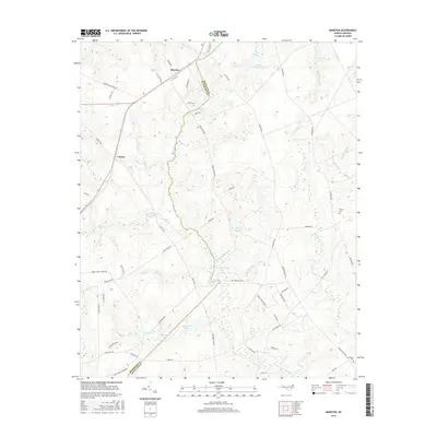
2016 Map of Marston
USGS Topo · Published 2016About this map
Marston and Cognac sit along the northwestern edge of this landscape, where the sandy hills of the Sandhills region meet a complex network of blackwater streams and Carolina bays. The terrain is defined by an intricate drainage system including Gum Swamp Cr and Hitchcock Cr, which feed into numerous named water bodies such as Scotland Lake and Kinney Cameron Lake. The boundary between Richmond Co and Scotland Co bisects the area, following natural watercourses like Gum Swamp Cr through the low-lying wetlands.
Find a feature on this map
63 named features on this map. Tap any name to fly to it.
Don’t see what you’re looking for? This feature index may not catch every label — zoom into the map to look around manually.
Map Details
Editions of this 2016 Marston Map
This is the sole edition of this map. No revisions or reprints were ever made.
Other maps of this area

1942 · Troy
USGS Topo · 1:125,000

1942 · Rockingham
USGS Topo · 1:125,000

1948 · Southern Pines
USGS Topo · 1:62,500

1948 · Pinebluff
USGS Topo · 1:24,000

1949 · Gibson
USGS Topo · 1:24,000

1949 · Millstone Lake
USGS Topo · 1:24,000

1949 · Ghio
USGS Topo · 1:24,000

1949 · Laurinburg
USGS Topo · 1:24,000

1949 · Silver Hill
USGS Topo · 1:24,000

1949 · Hoffman
USGS Topo · 1:24,000