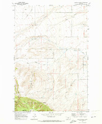
1970 Map of Martin Coulee
USGS Topo · Published 1973About this map
The boundary between Judith Basin Co and Wheatland Co runs through a landscape defined by deeply incised drainage systems and high plateaus. Surveyed at the turn of the 1970s, this area reflects a remote ranching and extraction environment where water sources like Coyote Creek and Hauck Coulee dictate the topography. In the southern portion of the quadrangle, the terrain rises into the Lewis and Clark National Forest, specifically featuring the Roughlock Hill and the headwaters of West Buffalo Creek. Evidence of local industry is scattered across the drainages, from several mines located near Saager Canyon to various gravel pits and a singular well. Connectivity is limited, relying heavily on a Jeep Trail that winds through the high country, providing access to the more inaccessible reaches of Martin Coulee.
Find a feature on this map
25 named features on this map. Tap any name to fly to it.
Don’t see what you’re looking for? This feature index may not catch every label — zoom into the map to look around manually.
Map Details
Editions of this 1970 Martin Coulee Map
This is the sole edition of this map. No revisions or reprints were ever made.
Other maps of this area

1886 · Little Belt Mts.
USGS Topo · 1:250,000

1889 · Big Snowy Mountain
USGS Topo · 1:250,000

1893 · Big Snowy Mountain
USGS Topo · 1:250,000

1894 · Little Belt Mts.
USGS Topo · 1:250,000

1897 · Little Belt Mts.
USGS Topo · 1:250,000

1898 · Little Belt Mts.
USGS Topo · 1:250,000

1902 · Little Belt Mts.
USGS Topo · 1:250,000

1948 · White Sulphur Springs
USGS Topo · 1:250,000

1954 · Roundup
USGS Topo · 1:250,000

1958 · Roundup
USGS Topo · 1:250,000