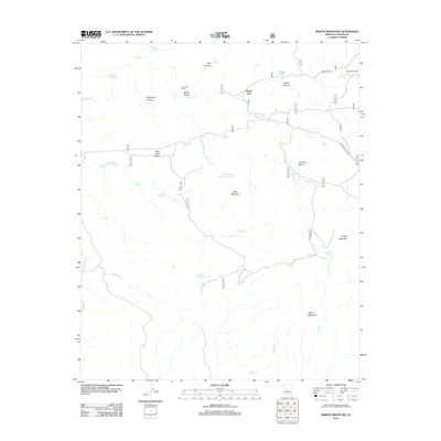
2012 Map of Martin Mountain
USGS Topo · Published 2012About this map
Martin Mountain and Bald Mountain dominate this high-desert landscape in Yavapai County, where ranching infrastructure defines the few human imprints on the land. In the northern reaches of the quadrangle, the Bar U Ranch and its associated Bar U Tank sit near the intersection of Z3 Ranch Rd and Ferguson Valley Rd. The importance of water management in this arid environment is evident through a network of remote catchments like Martin Mountain Tank, Stevens Tank, and North Bald Mountain Tank. Historic livestock management points such as the Sycamore Corral and the localized name of Wood Trap reflect the area's long-standing connection to the open range. Steep drainages like Weed Canyon and Hog Canyon feed into major seasonal watercourses such as Sycamore Cr and Wood Cr, which carve through the distinct geological formations of the Bubby Buttes and Tank Creek Mesa.
Find a feature on this map
35 named features on this map. Tap any name to fly to it.
Don’t see what you’re looking for? This feature index may not catch every label — zoom into the map to look around manually.
Map Details
Editions of this 2012 Martin Mountain Map
This is the sole edition of this map. No revisions or reprints were ever made.
Other maps of this area

1887 · Prescott
USGS Topo · 1:250,000

1892 · Prescott
USGS Topo · 1:250,000

1903 · Congress
USGS Topo · 1:125,000

1904 · Congress
USGS Topo · 1:125,000

1947 · Iron Springs
USGS Topo · 1:62,500

1947 · Kirkland
USGS Topo · 1:62,500

1947 · Sheridan Mountain
USGS Topo · 1:62,500

1948 · Sheridan Mountain
USGS Topo · 1:63,360

1948 · Iron Springs
USGS Topo · 1:63,360

1948 · Kirkland
USGS Topo · 1:63,360