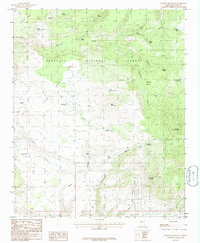
1986 Map of Martin Mountain
USGS Topo · Published 1986About this map
Prescott National Forest encompasses this high-elevation landscape, where the rugged topography is defined by prominent peaks and a complex network of seasonal water sources. The terrain rises to Martin Mountain and Bald Mountain, with the flat-topped Sycamore Mesa dominating the northwest. Numerous named springs and tanks, such as Dougherty Spring and Bar U Bar Tank, suggest a landscape managed for livestock or wildlife within the forest boundaries.
Find a feature on this map
34 named features on this map. Tap any name to fly to it.
Don’t see what you’re looking for? This feature index may not catch every label — zoom into the map to look around manually.
Map Details
Editions of this 1986 Martin Mountain Map
This is the sole edition of this map. No revisions or reprints were ever made.
Other maps of this area

1887 · Prescott
USGS Topo · 1:250,000

1892 · Prescott
USGS Topo · 1:250,000

1903 · Congress
USGS Topo · 1:125,000

1904 · Congress
USGS Topo · 1:125,000

1947 · Iron Springs
USGS Topo · 1:62,500

1947 · Kirkland
USGS Topo · 1:62,500

1947 · Sheridan Mountain
USGS Topo · 1:62,500

1948 · Sheridan Mountain
USGS Topo · 1:63,360

1948 · Iron Springs
USGS Topo · 1:63,360

1948 · Kirkland
USGS Topo · 1:63,360