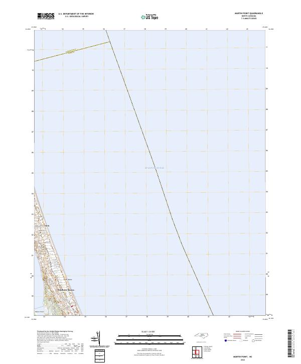
2022 Map of Martin Point
USGS Topo · Published 2022About this map
The narrow coastal strip of the Outer Banks dominates the western edge of this map, where the Atlantic coastline meets the developed residential corridors of Dare County. In the early 2020s, the communities of Duck and Southern Shores are defined by a dense network of residential streets such as Duck Rd and Ocean Blvd, illustrating the modern layout of these coastal resort areas. Further south, the map identifies Martin Point, situated where the land tapers toward the sound side of the peninsula.
Find a feature on this map
29 named features on this map. Tap any name to fly to it.
Don’t see what you’re looking for? This feature index may not catch every label — zoom into the map to look around manually.
Map Details
Editions of this 2022 Martin Point Map
This is the sole edition of this map. No revisions or reprints were ever made.
Other maps of this area

1940 · Barco
USGS Topo · 1:62,500

1940 · Kitty Hawk
USGS Topo · 1:62,500

1940 · Powells Point
USGS Topo · 1:62,500

1946 · Eastville
USGS Topo · 1:250,000

1946 · Currituck Sound
USGS Topo · 1:250,000

1961 · Eastville
USGS Topo · 1:250,000

1966 · Eastville
USGS Topo · 1:250,000
1982 · Jarvisburg
USGS Topo · 1:24,000
1982 · Kitty Hawk
USGS Topo · 1:24,000
1982 · Point Harbor
USGS Topo · 1:24,000