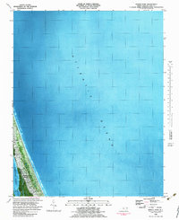
1982 Map of Martin Point
USGS Topo · Published 1983About this map
Southern Shores and the village of Duck occupy a narrow, developed barrier strip between the Atlantic Ocean and the shallow waters of the Currituck Sound in this early 1980s orthophotomap. Produced by the U.S. Geological Survey using 1977 aerial photography, this map visualizes the residential expansion along the Outer Banks before the significant late-century building boom. Small settlements like Sea Crest and the residential area at Martin Point are visible, alongside community landmarks such as a local Fire House and a coastal Campground. The landscape is defined by the thin peninsula’s vulnerability, with Jean Guite Cr cutting into the sound side, illustrating the delicate balance of coastal development in Dare County.
Find a feature on this map
9 named features on this map. Tap any name to fly to it.
Don’t see what you’re looking for? This feature index may not catch every label — zoom into the map to look around manually.
Map Details
Editions of this 1982 Martin Point Map
This is the sole edition of this map. No revisions or reprints were ever made.
Other maps of this area

1940 · Barco
USGS Topo · 1:62,500

1940 · Kitty Hawk
USGS Topo · 1:62,500

1940 · Powells Point
USGS Topo · 1:62,500

1946 · Eastville
USGS Topo · 1:250,000

1946 · Currituck Sound
USGS Topo · 1:250,000

1961 · Eastville
USGS Topo · 1:250,000

1966 · Eastville
USGS Topo · 1:250,000
1982 · Jarvisburg
USGS Topo · 1:24,000
1982 · Kitty Hawk
USGS Topo · 1:24,000
1982 · Point Harbor
USGS Topo · 1:24,000