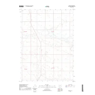
2017 Map of Martin SW
USGS Topo · Published 2017About this map
The prairie landscape of t36n r37w and t36n r38w in Bennett County reveals a sparse but distinct hydrographic network within the Sand Hills region. The upper reaches of Lake Cr dominate the northern and central sections, weaving through a complex series of seasonal wetlands and small depressions characteristic of this high-plains environment. This 2017 study illustrates the delicate drainage patterns that define the South Dakota ranchlands, where the land is organized according to the Public Land Survey System boundaries of t35n r37w and t35n r38w. To the east, the headwaters of Cedar Cr emerge, cutting through the terrain and providing critical water resources for the isolated homesteads and agricultural operations that rely on these intermittent seasonal flows.
Find a feature on this map
6 named features on this map. Tap any name to fly to it.
Don’t see what you’re looking for? This feature index may not catch every label — zoom into the map to look around manually.
Map Details
Editions of this 2017 Martin SW Map
This is the sole edition of this map. No revisions or reprints were ever made.
Other maps of this area

1950 · Irwin
USGS Topo · 1:62,500

1951 · Irwin
USGS Topo · 1:62,500

1951 · Merriman
USGS Topo · 1:62,500

1955 · Martin
USGS Topo · 1:250,000

1957 · Valentine
USGS Topo · 1:250,000

1958 · Martin
USGS Topo · 1:250,000

1959 · Valentine
USGS Topo · 1:250,000

1981 · Phantom Lake
USGS Topo · 1:25,000

1981 · Martin
USGS Topo · 1:25,000

1981 · Ecoffey Lake
USGS Topo · 1:25,000