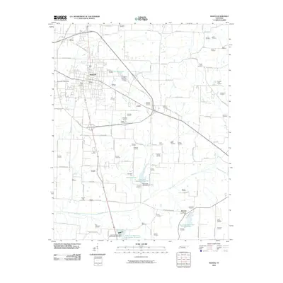
2010 Map of Martin
USGS Topo · Published 2010About this map
Martin serves as the focal point of this Northwest Tennessee landscape, where the University of Tennessee campus and urban expansion meet a rural agricultural periphery. The map is notably dense with burial grounds, including the Yellow Fever Cemetery, a poignant reminder of past epidemics in the region. Other significant family and community plots such as Dibrell Cemetery, Rice-Underwood Cemetery, and Old Salem Cemetery are scattered throughout the countryside, offering deep genealogical value. Water management is a defining characteristic of the terrain, visible through the series of reservoirs and dams along Mud Creek, including Mud Creek Watershed Lake Five and Mud Creek Watershed Lake Fifteen. These engineered lakes, alongside W F Baker Lake and Randolph Lake, illustrate the region's historical efforts to control drainage and provide local recreation.
Find a feature on this map
112 named features on this map. Tap any name to fly to it.
Don’t see what you’re looking for? This feature index may not catch every label — zoom into the map to look around manually.
Map Details
Editions of this 2010 Martin Map
This is the sole edition of this map. No revisions or reprints were ever made.
Other maps of this area

1950 · Martin
USGS Topo · 1:24,000

1952 · Dresden
USGS Topo · 1:24,000

1954 · Rutherford
USGS Topo · 1:24,000

1954 · Greenfield
USGS Topo · 1:24,000

1956 · Gardner
USGS Topo · 1:24,000

1956 · Harris
USGS Topo · 1:24,000

1956 · Mc Connell
USGS Topo · 1:24,000

1956 · Latham
USGS Topo · 1:24,000

1956 · Dyersburg
USGS Topo · 1:250,000

1967 · Pillowville
USGS Topo · 1:24,000