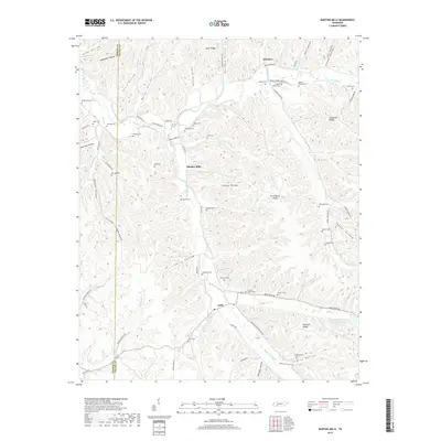
2019 Map of Martins Mills
USGS Topo · Published 2019About this map
Lutts and Martins Mills serve as the primary focal points of this Tennessee survey, situated in a terrain defined by the complex drainage of Weatherford Creek and Indian Creek. The area is notably dense with family burying grounds and community cemeteries, indicating a long-established rural population scattered across ridges like Atkinson Ridge and Copeland Ridge. To the north, the small settlement of Houston lies near the headwaters of Davis Br and Petit Hollow Br. The landscape is etched with deep valleys such as Downing Hollow and Lindsey Hollow, where small family names mark the map, including Nowlin Family Cem and Melson Cem. The presence of Greeson Chapel Cem suggests the historical importance of small country parishes in connecting these isolated hollows through a network of early roads like Old Weatherford Creek Rd.
Find a feature on this map
92 named features on this map. Tap any name to fly to it.
Don’t see what you’re looking for? This feature index may not catch every label — zoom into the map to look around manually.
Map Details
Editions of this 2019 Martins Mills Map
This is the sole edition of this map. No revisions or reprints were ever made.
Other maps of this area

1905 · Waynesboro
USGS Topo · 1:125,000

1936 · Wolf Pit Ridge
USGS Topo · 1:24,000

1936 · Eagle Creek
USGS Topo · 1:24,000

1936 · Olivehill
USGS Topo · 1:24,000

1936 · Cypress Inn
USGS Topo · 1:24,000

1936 · Three Churches
USGS Topo · 1:24,000

1936 · Ransom Stand
USGS Topo · 1:24,000

1936 · Lowryville
USGS Topo · 1:24,000

1936 · Waynesboro
USGS Topo · 1:24,000

1936 · Martins Mills
USGS Topo · 1:24,000