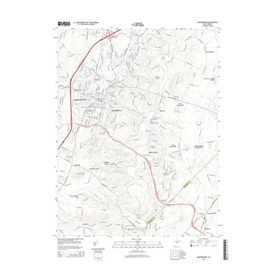
2014 Map of Martinsburg
USGS Topo · Published 2014About this map
Martinsburg serves as the focal point of this Eastern Panhandle survey, showing a landscape defined by its historic cemeteries and the winding course of Opequon Creek. The area’s deep roots are visible in sites such as the Old German Lutheran Reformed Cem and Providence Quaker Cem, reflecting the diverse denominational history of Berkeley County. While the city exhibits modern growth around the Eastern WV Regional Airport/Shepherd Field, many surrounding hamlets like Grubbs Corner, Files Crossroad, and Van Clevesville retain their early crossroads character.
Find a feature on this map
62 named features on this map. Tap any name to fly to it.
Don’t see what you’re looking for? This feature index may not catch every label — zoom into the map to look around manually.
Map Details
Editions of this 2014 Martinsburg Map
This is the sole edition of this map. No revisions or reprints were ever made.
Other maps of this area

1884 · Harpers Ferry
USGS Topo · 1:125,000

1891 · Harpers Ferry
USGS Topo · 1:125,000

1893 · Harpers Ferry
USGS Topo · 1:125,000

1894 · Winchester
USGS Topo · 1:125,000

1899 · Hancock
USGS Topo · 1:62,500

1901 · Hancock
USGS Topo · 1:62,500

1912 · Williamsport
USGS Topo · 1:62,500

1914 · Martinsburg
USGS Topo · 1:48,000

1914 · Gerrardstown
USGS Topo · 1:48,000

1916 · Gerrardstown
USGS Topo · 1:62,500