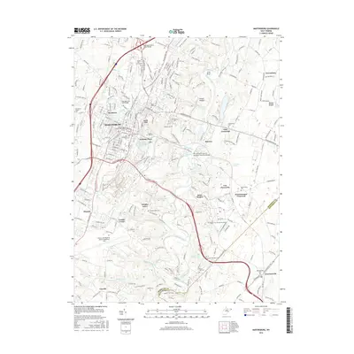
2016 Map of Martinsburg
USGS Topo · Published 2016About this map
Martinsburg and its surrounding crossroads are the focal point of this 2016 survey, where the dense street grid of neighborhoods like Irish Hill and Berkeley Place meets the winding path of Opequon Creek. The landscape is heavily marked by its religious and civic history, evidenced by a high density of burial grounds ranging from the Old German Lutheran Reformed Cem to the modern Pleasant View Memory Gardens. To the south, the Eastern WV Regional Airport/Shepherd Field occupies a large tract near the Berkeley Co Jefferson Co line, reflecting the area's role as a regional transportation hub. Smaller rural clusters such as Files Crossroad and Winebrenners Crossroad sit among the many springs and runs that feed into the larger creek system, including Couchman Springs and Van Meter Spring. This transition from an urban center to agricultural crossroads preserves the names of early settlements like Vanville and Kearneysville.
Find a feature on this map
60 named features on this map. Tap any name to fly to it.
Don’t see what you’re looking for? This feature index may not catch every label — zoom into the map to look around manually.
Map Details
Editions of this 2016 Martinsburg Map
This is the sole edition of this map. No revisions or reprints were ever made.
Other maps of this area

1884 · Harpers Ferry
USGS Topo · 1:125,000

1891 · Harpers Ferry
USGS Topo · 1:125,000

1893 · Harpers Ferry
USGS Topo · 1:125,000

1894 · Winchester
USGS Topo · 1:125,000

1899 · Hancock
USGS Topo · 1:62,500

1901 · Hancock
USGS Topo · 1:62,500

1912 · Williamsport
USGS Topo · 1:62,500

1914 · Martinsburg
USGS Topo · 1:48,000

1914 · Gerrardstown
USGS Topo · 1:48,000

1916 · Gerrardstown
USGS Topo · 1:62,500